Kartavkalns nature trail
Nature trails, Accessible to parents with baby-strollers, Partly accessible

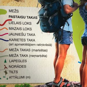
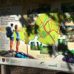
Object list
Watch the trail video:
Description:
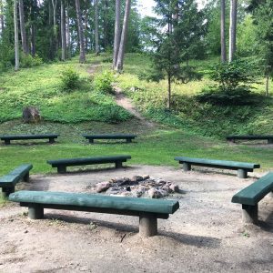
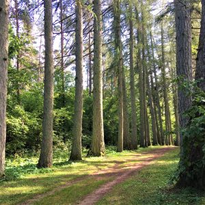
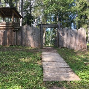
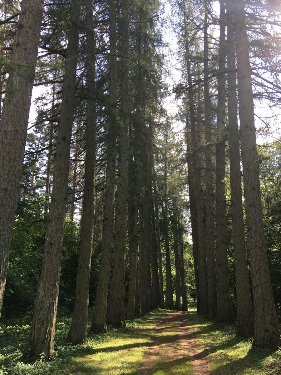
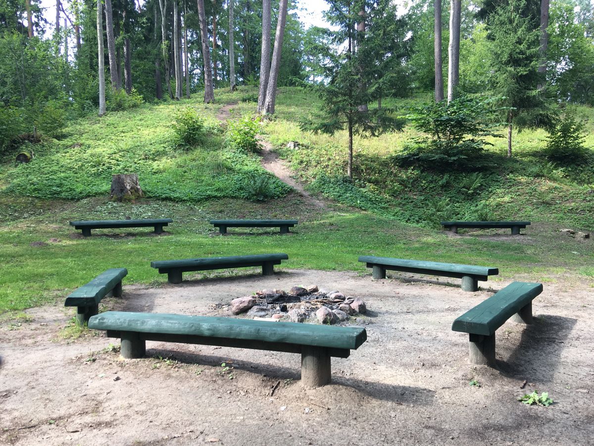
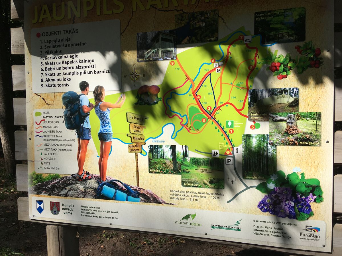
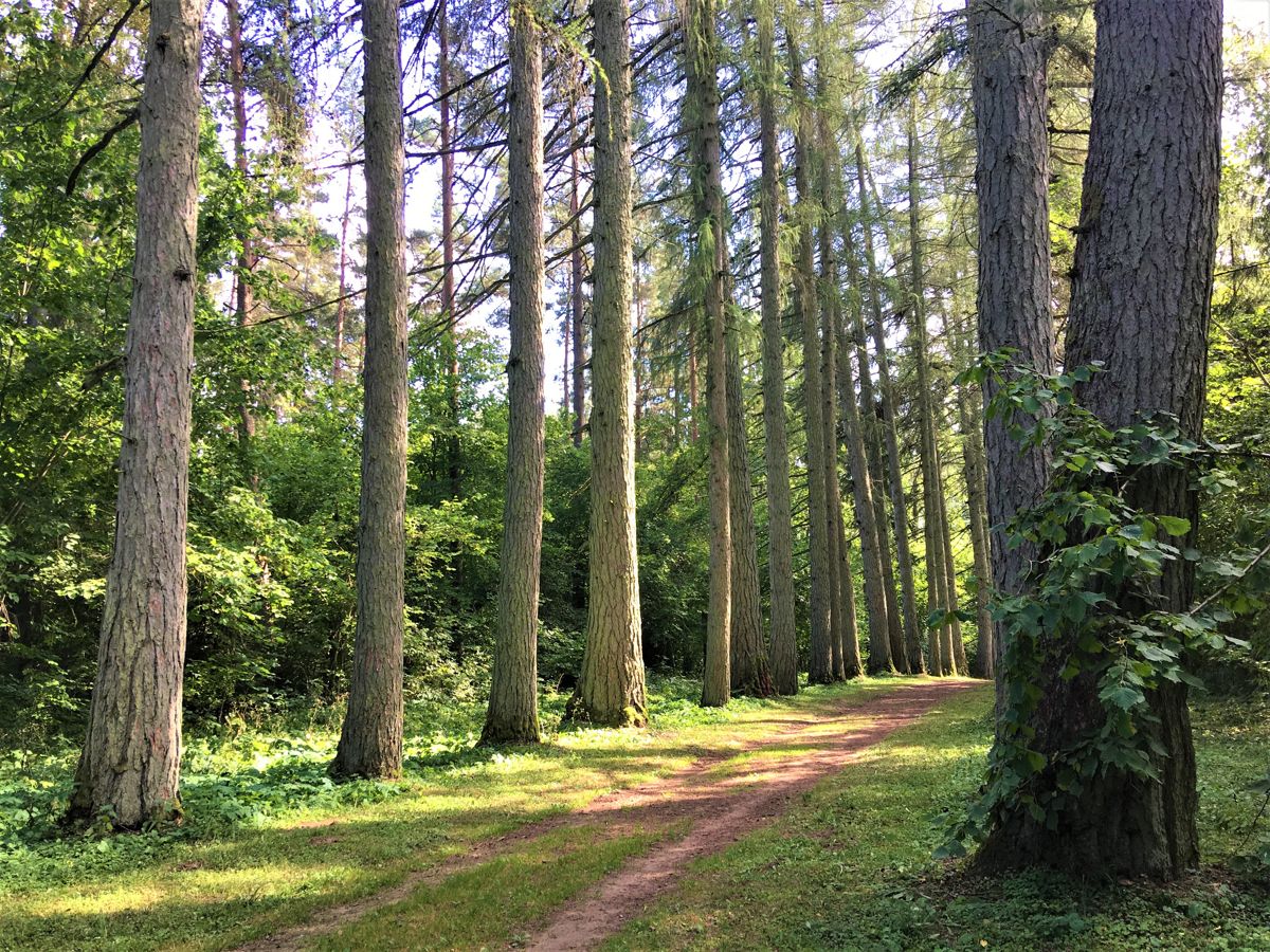
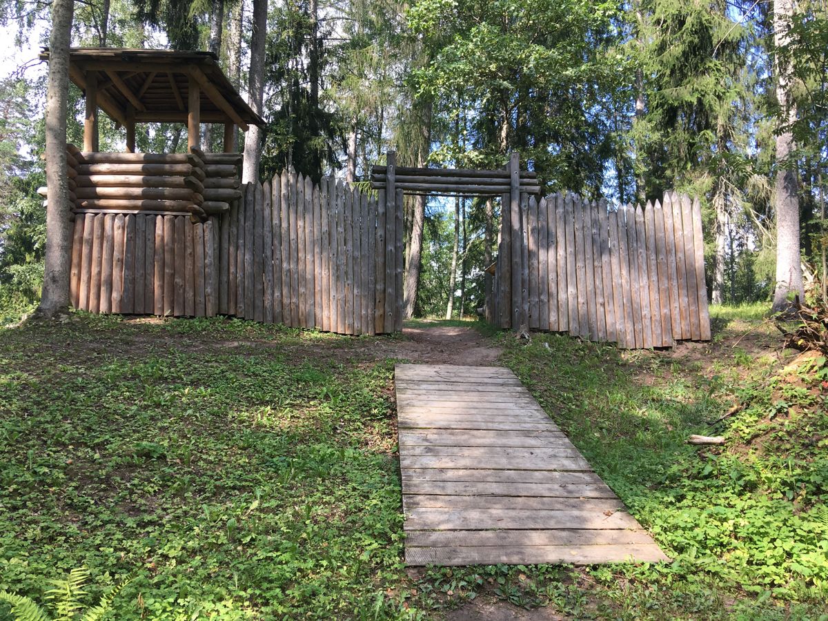
Kartavkalni is a wide area with a number of walking routes that stretch through the hillocks overgrown with forests for a distance of more than 3 km. The name Kartavkalns comes from gallows (latv. – “karātavas”), which were built here 300 years ago to protect the area against robbers. An ancient Semigallian settlement used to be here in the past. The first stretch of the trail – the impressive larch lane – is also accessible to people in wheelchairs. It is possible to reach the resting and picnic area, as well as see the ancient hillfort and the reproduction of the ancient latvian settlement. Few tree roots might be an obstacle in some places, therefore assistant is recommended. Further trail stretches are not accessible.
Accessibility
Facilities
Rules to follow
Download the GPX of the trail
In order to open the GPX file with the trail route on a mobile phone or computer, please install one of the hiking apps or maps, e.g., Wikiloc, Outdooractive, ViewRanger, OS Maps or any other GPX file reading programme or application.
6 Photos

Close
Location:
Nature Monument Kartavkalns Lane, Biksti Parish

Suggested starting point:
Parking lot at Sparvu burial-ground
GPS coordinates:
Lat:56.71504, Lon:23.01970Hiking time:
20 min

Distance:
0,25 km (one direction)

Marking:
Not marked, but can easily follow the trail

Trail surface:
Path, on average 1,5m wide

Type:
Out&back (only the larch lane up to the resting and picnic area is accessible)
Getting there:
With a car. With a bus till Jaunpils.

Trail administrator:
Jaunpils County Municipality, T: +371 63107069, E: dome@jaunpils.lv
Info:
Jaunpils Tourism Information Point, Jaunpils Castle, “Pils”, Jaunpils, T: +371 26164405, turisms@jaunpils.lv, www.jaunpils.lv/turisms.php
Closest shops, gas stations:
Jaunpils
Slope:
A slight slope in the beginning of the larch lane, but overall the lane is accessible
Watch the trail video:
Description:
Kartavkalni is a wide area with a number of walking routes that stretch through the hillocks overgrown with forests for a distance of more than 3 km. The name Kartavkalns comes from gallows (latv. – “karātavas”), which were built here 300 years ago to protect the area against robbers. An ancient Semigallian settlement used to be here in the past. The first stretch of the trail – the impressive larch lane – is also accessible to people in wheelchairs. It is possible to reach the resting and picnic area, as well as see the ancient hillfort and the reproduction of the ancient latvian settlement. Few tree roots might be an obstacle in some places, therefore assistant is recommended. Further trail stretches are not accessible.
Accessibility
Facilities
Rules to follow
Download the GPX of the trail
In order to open the GPX file with the trail route on a mobile phone or computer, please install one of the hiking apps or maps, e.g., Wikiloc, Outdooractive, ViewRanger, OS Maps or any other GPX file reading programme or application.
6 Photos
Close