Peukaloisen Polku Trail
Nature trails, Accessible to parents with baby-strollers, Accessible toilet, Partly accessible

Object list
Watch the trail video:
Description:
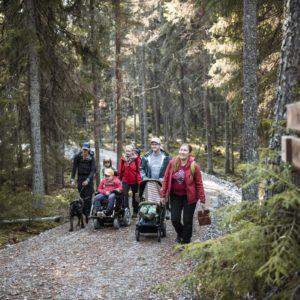
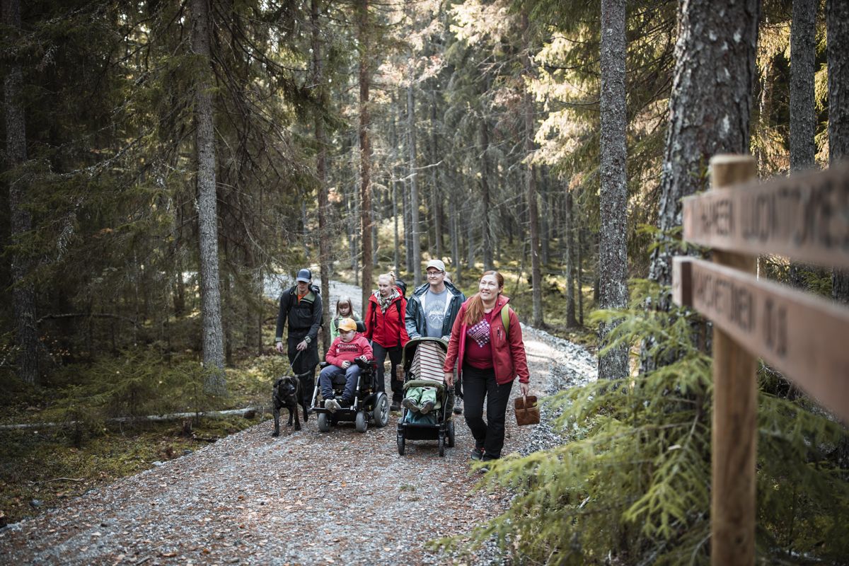
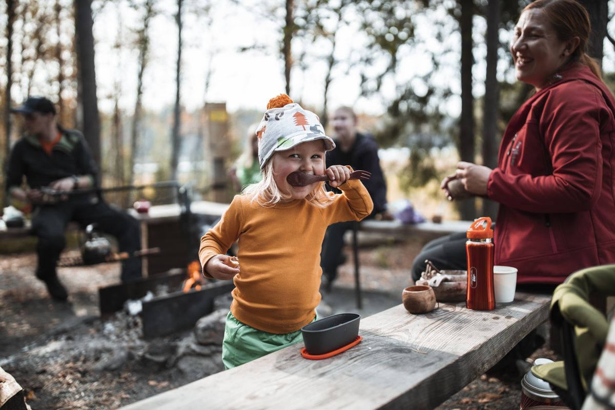
Lakes and scenic forests dominate the northern part of Liesjärvi National Park. One can easily spend half day or longer on the Peukaloisenpolku Trail – possibly even overnight there enjoying the landscape. The trail is one of the longest accessible trails in Southern Finland. At the end of the year 2020, the trail was almost ready. The trail is demanding – as it features a few points with inclinations, so assitance is needed for visitors in wheelchairs.
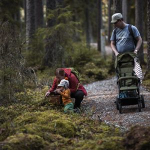
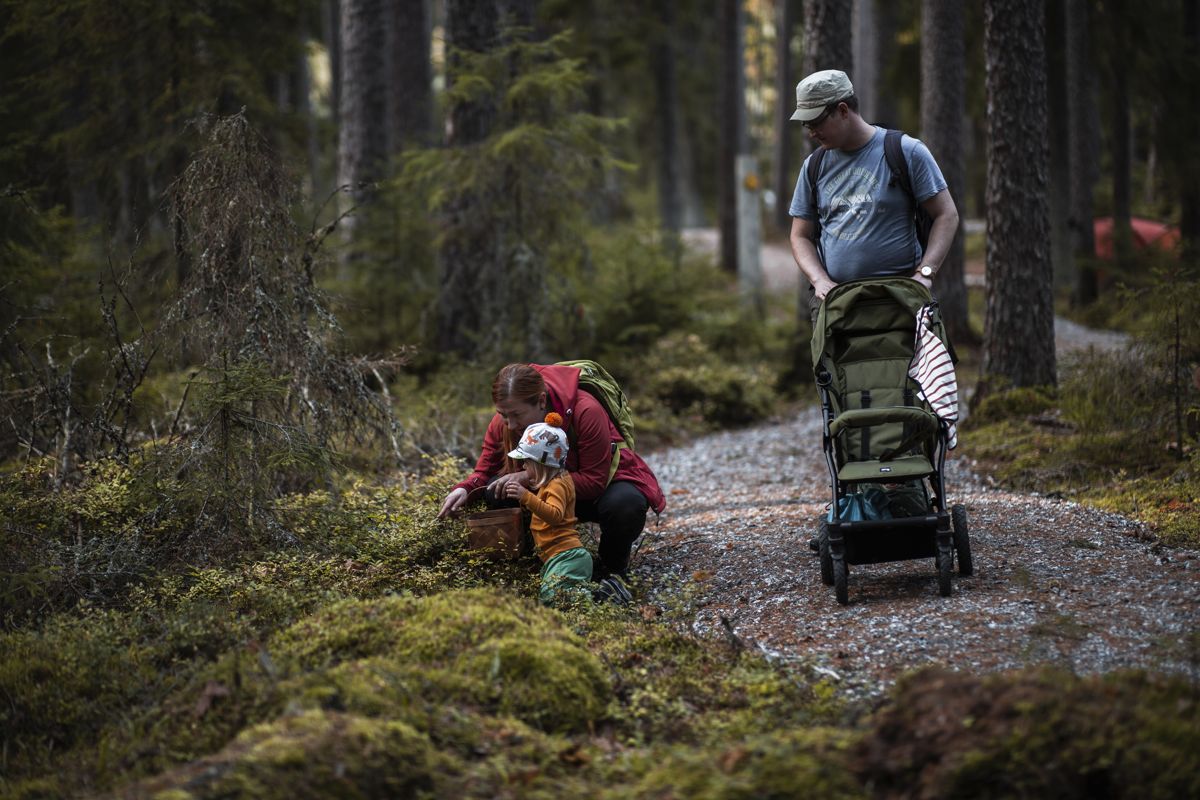
The trail begins at Peukalampi parking lot. When travelling clockwise, the first strecth (1,5 km) follows a 2,5 m wide graveled road. This strech ends at Tittilampi, which is a rental campsite with accessible service for groups; a hut, a dry toilet and a fire pit.
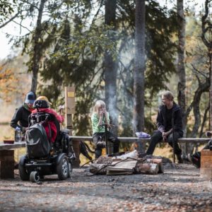
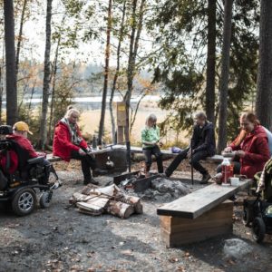
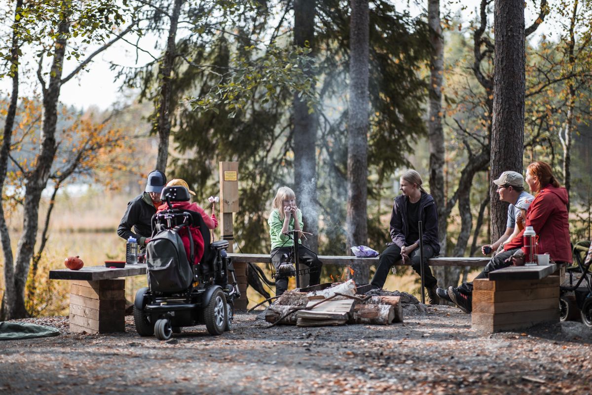
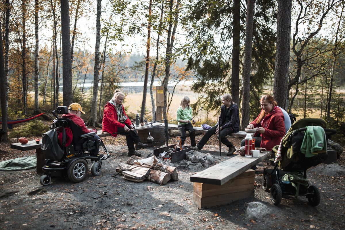
Tittilampi trail continues along a 2,5 m wide graveled road for another 800 m until a rest area called Kaksvetinen. An accessible campfire place, a Lapp hut and a dry toilet are situated beside a beautiful lake. Staying overnight is an option in the Lapp hut, as is lighting a campfire during a forest fire alarm.
The stretch of trail from Kaksvetinen to the rest area by Peukalolammi is 1,2 km long and at least 1,2 m wide. Beautiful forests surround you the whole way. At Peukalolammi the accessible campfire place and toilet are situated on top of the small hill. From there, the trail follows a 2,5 m wide road to the parking lot. The length of this section is 600 m. The narrowest point on the trail is at the end beside a roadblock; 1,2 m.
Accessibility
How to get there: Coming from Helsinki, 17 km before the city of Forssa, turn right from Route 2 onto Kanteluksentie Road. Follow this road for 5.8 kilometres and turn left onto Katavalammintie Road. After driving 300 metres, you will find the parking lot.
Facilities
Rules to follow
Download the GPX of the trail
In order to open the GPX file with the trail route on a mobile phone or computer, please install one of the hiking apps or maps, e.g., Wikiloc, Outdooractive, ViewRanger, OS Maps or any other GPX file reading programme or application.
5 Photos

Close
Photos: Maarit Vaahteranoksa
Location:
Liesjärvi National Park, Tammela
Suggested starting point:
Peukalolampi parking lot, Katavalammintie
GPS coordinates:
Lat:60.69567, Lon:23.87480Hiking time:
2,5 h

Distance:
4,5 km

Marking:
White wooden square with coloured hoop inside

Trail surface:
Gravel

Type:
Loop
Getting there:
With a car

Trail administrator:
Metsähallitus, Parks & Wildlife Finland, Coastal and Metropolitan Area, nationalparks.fi/contactus
Info:
T: +358 (0)0206 39 5270, E: sisasuomi@metsa.fi, www.nationalparks.fi/liesjarvi
Closest shops, gas stations:
Tammela
Slope:
Between the parking lot and Kaksvetinen there are few slopes. The section from Kaksvetinen to Peukalolammi is mostly easy and gentle, featuring only a few short, mostly 5 m long slopes, inclination varies between 10 and 14%. Peukalammi Trail takes you over a small hill and inclinations on both sides are 12% and 13%. Along the road from Peukalolammi to the parking lot, inclination exceeds 8% at four points: 16% (28 m), 12% (11 m), 13% (10 m) and 14% (21 m).
Watch the trail video:
Description:
Lakes and scenic forests dominate the northern part of Liesjärvi National Park. One can easily spend half day or longer on the Peukaloisenpolku Trail – possibly even overnight there enjoying the landscape. The trail is one of the longest accessible trails in Southern Finland. At the end of the year 2020, the trail was almost ready. The trail is demanding – as it features a few points with inclinations, so assitance is needed for visitors in wheelchairs.
The trail begins at Peukalampi parking lot. When travelling clockwise, the first strecth (1,5 km) follows a 2,5 m wide graveled road. This strech ends at Tittilampi, which is a rental campsite with accessible service for groups; a hut, a dry toilet and a fire pit.
Tittilampi trail continues along a 2,5 m wide graveled road for another 800 m until a rest area called Kaksvetinen. An accessible campfire place, a Lapp hut and a dry toilet are situated beside a beautiful lake. Staying overnight is an option in the Lapp hut, as is lighting a campfire during a forest fire alarm.
The stretch of trail from Kaksvetinen to the rest area by Peukalolammi is 1,2 km long and at least 1,2 m wide. Beautiful forests surround you the whole way. At Peukalolammi the accessible campfire place and toilet are situated on top of the small hill. From there, the trail follows a 2,5 m wide road to the parking lot. The length of this section is 600 m. The narrowest point on the trail is at the end beside a roadblock; 1,2 m.
Accessibility
How to get there: Coming from Helsinki, 17 km before the city of Forssa, turn right from Route 2 onto Kanteluksentie Road. Follow this road for 5.8 kilometres and turn left onto Katavalammintie Road. After driving 300 metres, you will find the parking lot.
Facilities
Rules to follow
Download the GPX of the trail
In order to open the GPX file with the trail route on a mobile phone or computer, please install one of the hiking apps or maps, e.g., Wikiloc, Outdooractive, ViewRanger, OS Maps or any other GPX file reading programme or application.
5 Photos
Close
Photos: Maarit Vaahteranoksa