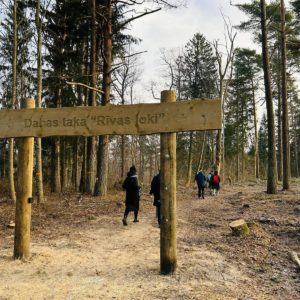
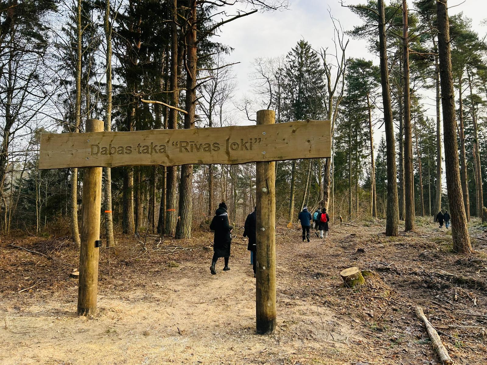
Nature trail Rīva Loki
Nature trails, Accessible, Accessible to parents with baby-strollers

Object list
Description
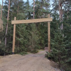
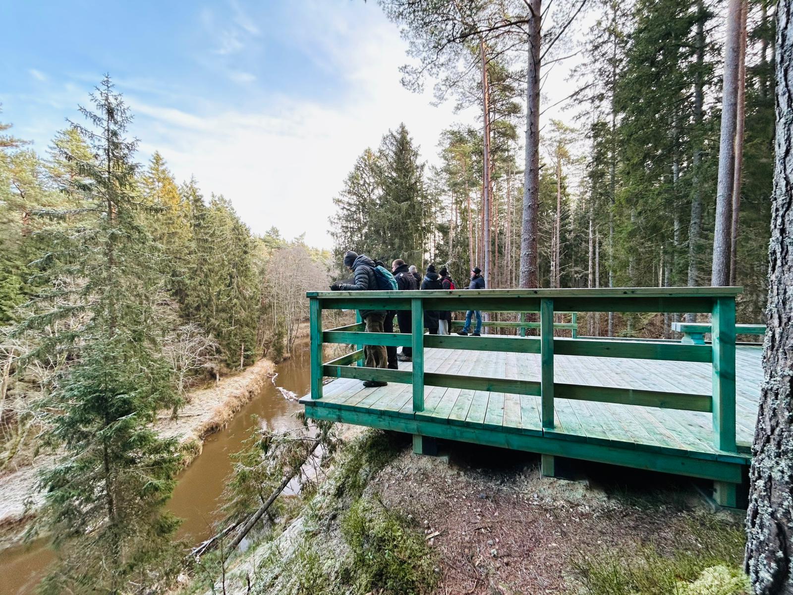
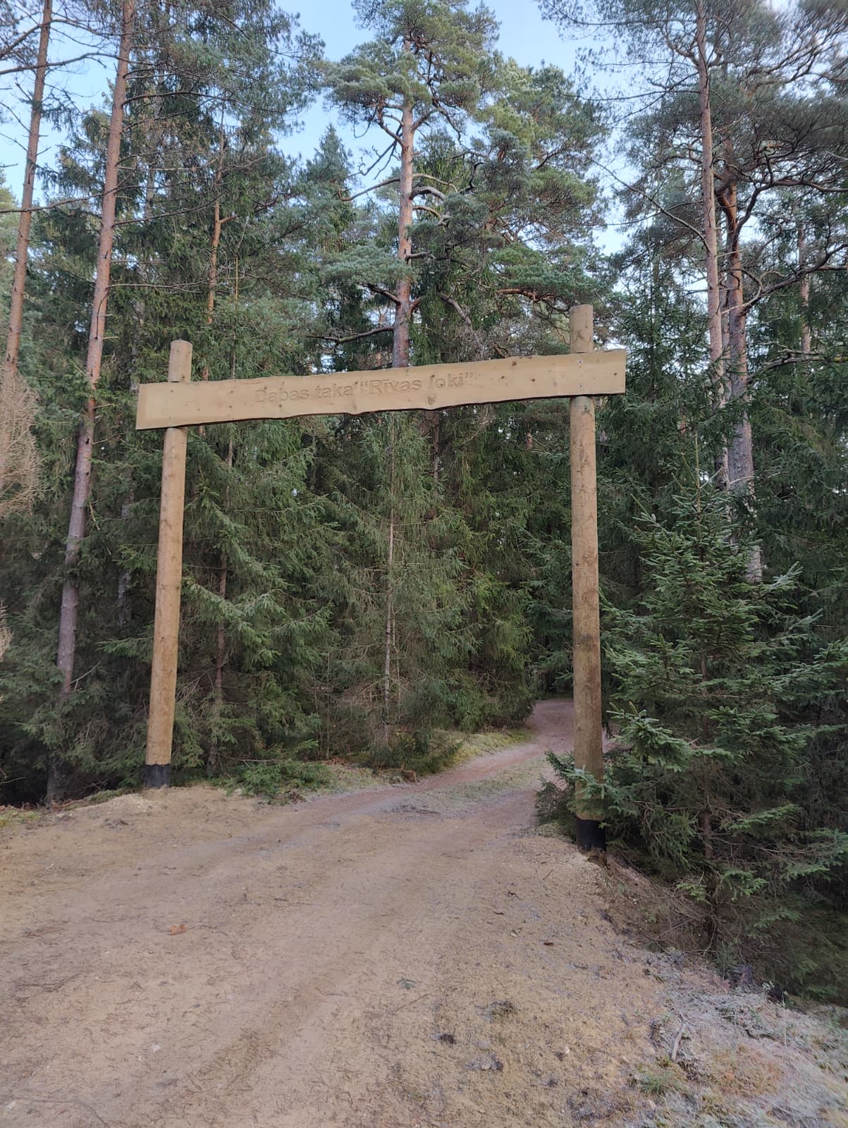
Starting point: Ulmale – Labraga Evangelical Lutheran Church. Traveling along road V1186 by car, about 1 km from the church, there is a specially constructed access gate for vehicles, providing an opportunity for people with mobility impairments to reach the trail’s observation platform and enjoy the path.
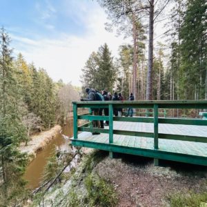
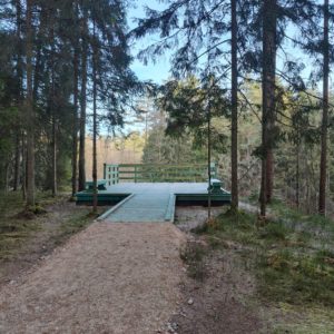
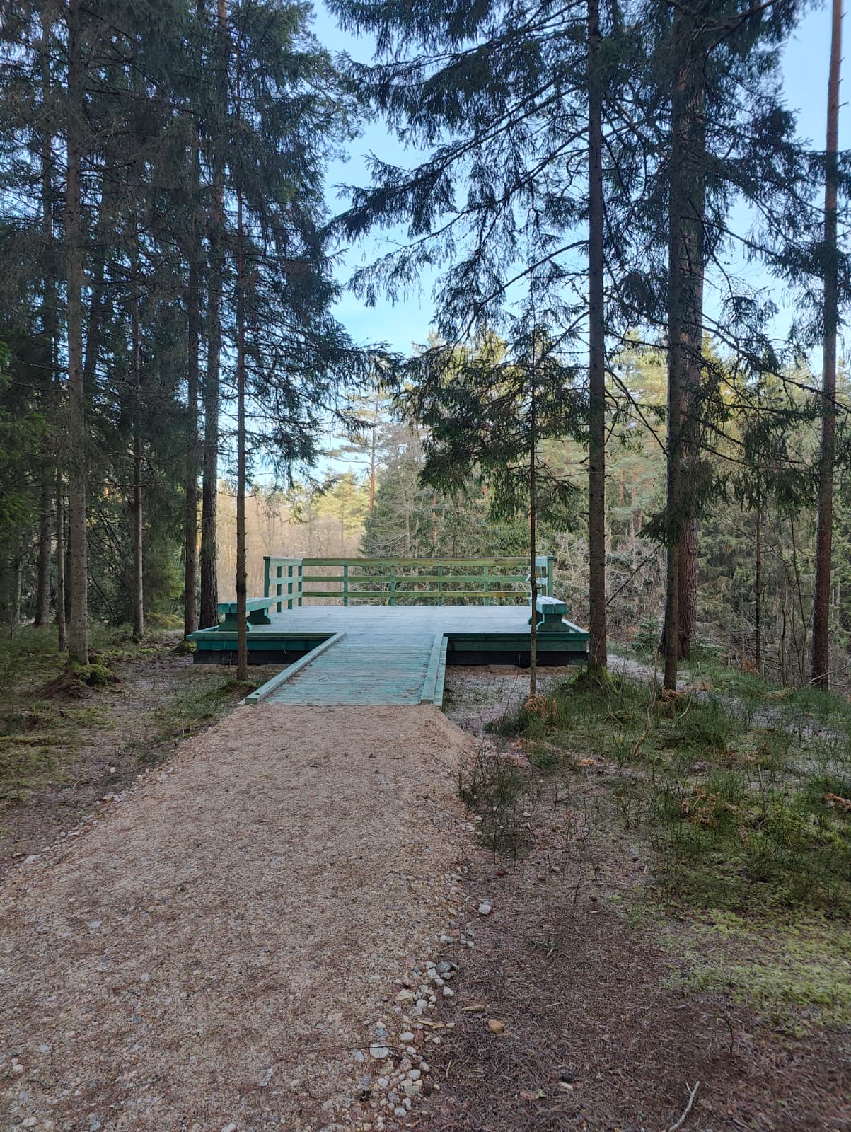
The trail winds along the banks of the Rīva River and is rich in stunning natural scenery. Along the path, a completely new observation platform has been built, along with entrance gates and informational stands.
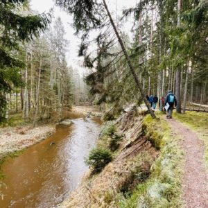
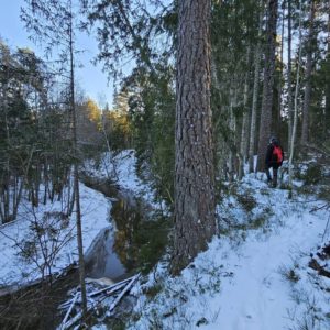
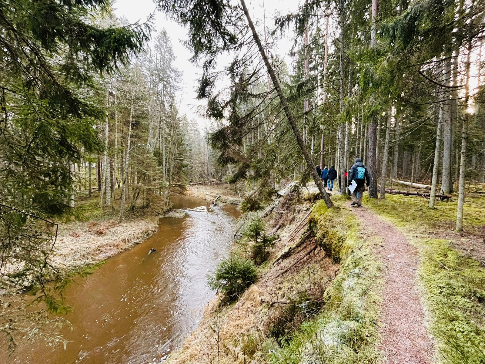
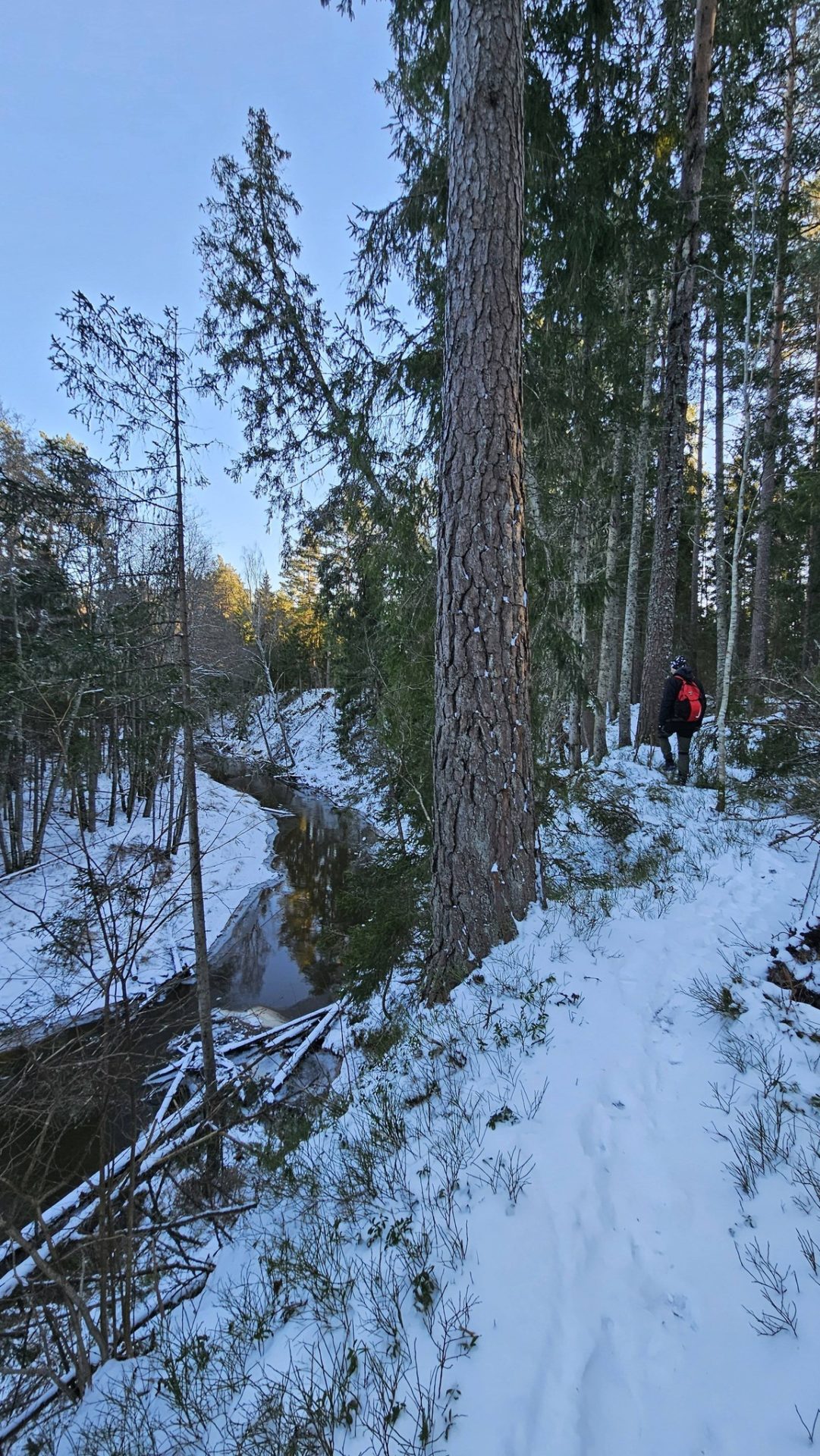
The trail is designed to lead away from the sea, meandering up and down the picturesque ancient valley of the Rīva River. The river flows through a canyon-like gorge, reaching depths of up to 12 meters. Visitors can enjoy countless river bends, steep bank cliffs, and a variety of striking natural landscapes and plant life. If lucky, one might spot a kingfisher or a black stork.
The river is most suitable for boating in spring and autumn.
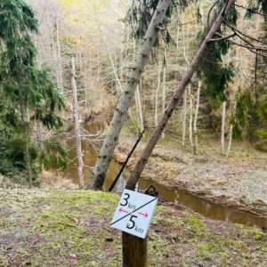
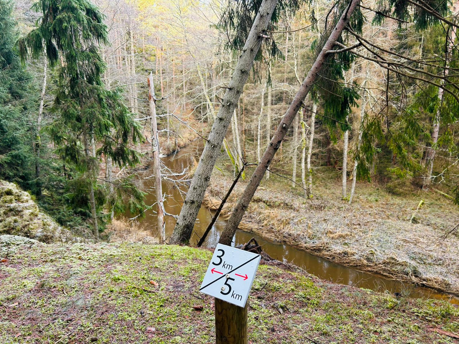
This route is suitable for active hikers, with a total distance of 8 km, typically taking around 2.5 hours to complete. Several rest areas with benches and fire pits are available along the way.
The trail is marked with a square – blue/green.
The route is linear, and it is possible to return along the road (4 km back to the trailhead). However, public transport does not operate in this area, so it is important to plan your return journey in advance or be prepared to walk back.
Accessibility
Facilities
7 Photos
Close
In order to open the GPX file with the trail route on a mobile phone or computer, please install one of the hiking apps or maps, e.g., Wikiloc, Outdooractive, ViewRanger, OS Maps or any other GPX file reading programme or application.
GPS coordinates:
56.972544, 21.355461
Trail length:
8 km (one way)

Type of trail:
Linear

Surface:
Well-trodden path, forest road
Description
Starting point: Ulmale – Labraga Evangelical Lutheran Church. Traveling along road V1186 by car, about 1 km from the church, there is a specially constructed access gate for vehicles, providing an opportunity for people with mobility impairments to reach the trail’s observation platform and enjoy the path.
The trail winds along the banks of the Rīva River and is rich in stunning natural scenery. Along the path, a completely new observation platform has been built, along with entrance gates and informational stands.
The trail is designed to lead away from the sea, meandering up and down the picturesque ancient valley of the Rīva River. The river flows through a canyon-like gorge, reaching depths of up to 12 meters. Visitors can enjoy countless river bends, steep bank cliffs, and a variety of striking natural landscapes and plant life. If lucky, one might spot a kingfisher or a black stork.
The river is most suitable for boating in spring and autumn.
This route is suitable for active hikers, with a total distance of 8 km, typically taking around 2.5 hours to complete. Several rest areas with benches and fire pits are available along the way.
The trail is marked with a square – blue/green.
The route is linear, and it is possible to return along the road (4 km back to the trailhead). However, public transport does not operate in this area, so it is important to plan your return journey in advance or be prepared to walk back.
Accessibility
Facilities
7 Photos
Close
In order to open the GPX file with the trail route on a mobile phone or computer, please install one of the hiking apps or maps, e.g., Wikiloc, Outdooractive, ViewRanger, OS Maps or any other GPX file reading programme or application.